Nature
Marker Wadden in autumn: the last sailing weeks to the islands behind the Houtribdijk
Until the last sailing weekend on 31 October and 1 November, the ferry still runs from Lelystad to Marker Wadden. Why the islands are there, what the dike next to them has to do with it, and which birds you see there in autumn.
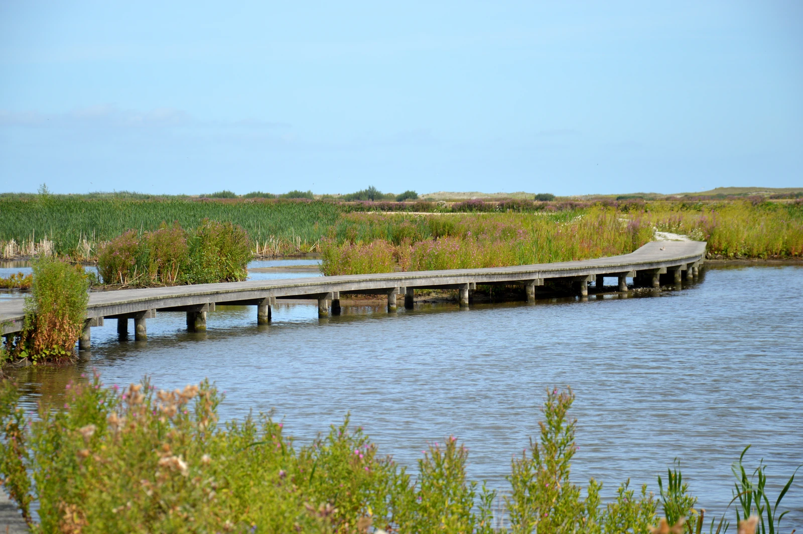
If you still want to visit Marker Wadden this year, don’t wait too long. The last sailing weekend of the season is on 31 October and 1 November, writes Natuurmonumenten, the nature conservation organisation that manages the islands. Janna, 3 Violas and Ruben Hein will then give acoustic concerts in the island pavilion. The sailing season runs from late March to early November; according to the timetable, the ferry leaves the Bataviahaven in Lelystad at 10.00, returning at 14.00, and at 13.00, returning at 17.00. The crossing takes about three quarters of an hour and you have just over three hours on the island.
Islands made of silt
Marker Wadden is a group of nature islands in the middle of the Markermeer, built up from sand, clay and silt that comes from the lake itself. Natuurmonumenten built them together with Rijkswaterstaat and Boskalis between 2016 and 2021. The project is meant to restore the nature of the Markermeer. According to Natuurmonumenten, the dike between Enkhuizen and Lelystad turned the Markermeer into a static lake: the natural movement disappeared, and with it much of the life in and around the water. The silt never came to rest. Behind the islands, out of the wind, it can sink to the bottom again. The water becomes clear there, which benefits plants, fish and birds.
Building with so much silt was new, and it shows. Natuurmonumenten reported in February that storms, together with high water, had damaged banks and beaches in recent years. The silt that had been pumped in had also sunk further or faster than expected in a number of places in the marsh. That report of 23 February said that Boskalis was busy that winter spraying new sand onto the beaches and raising marsh areas with silt; according to the schedule, the work was to be finished in March.
The dike without a polder
The dike on the horizon is the Houtribdijk, also called the Markerwaarddijk: a 26-kilometre dam between Lelystad and Enkhuizen. According to Rijkswaterstaat, the national water authority, it was built between 1963 and 1976, from both ends at once, until the last gap was closed on 4 September 1975. That is how the Markermeer came into being. The dike was meant as the edge of a new polder, the Markerwaard. According to Rijkswaterstaat, that polder never came because it would have turned out badly for the surrounding nature. Since it has water on both sides, it is technically a dam.
The N307 runs across the dam. From 21 October, vehicles heavier than 15 tonnes, or with more than 7.3 tonnes on a single axle, may no longer use it. The movable bridges at the Houtribsluizen near Lelystad show cracks in parts of the steel structure, and the fixed bridges are outdated, Rijkswaterstaat reports. Cars, emergency services and vans can continue to use the route. Rijkswaterstaat expects that the measure may stay in place for years.
Rush hour for birds
In autumn it is "real rush hour" on Marker Wadden, according to Natuurmonumenten. While the last bluethroats head south, migrants from Scandinavia drop in, including redwings, song thrushes and fieldfares; some stay only a day to refuel. You have a good chance of seeing bearded reedlings, as they spend the winter in the Netherlands. With a bit of luck there are already snow buntings too, the first winter visitors from the north. From the Lepelaar hide, at a height of 3.5 metres, you can watch the birds that land on the island in spring and autumn to feed.
The spoonbill itself has also bred there since this year. In June, Natuurmonumenten reported that drone images showed at least three nests on the ground, among the large gulls. Especially in late summer, according to Natuurmonumenten, more than a hundred spoonbills can stay on the islands.
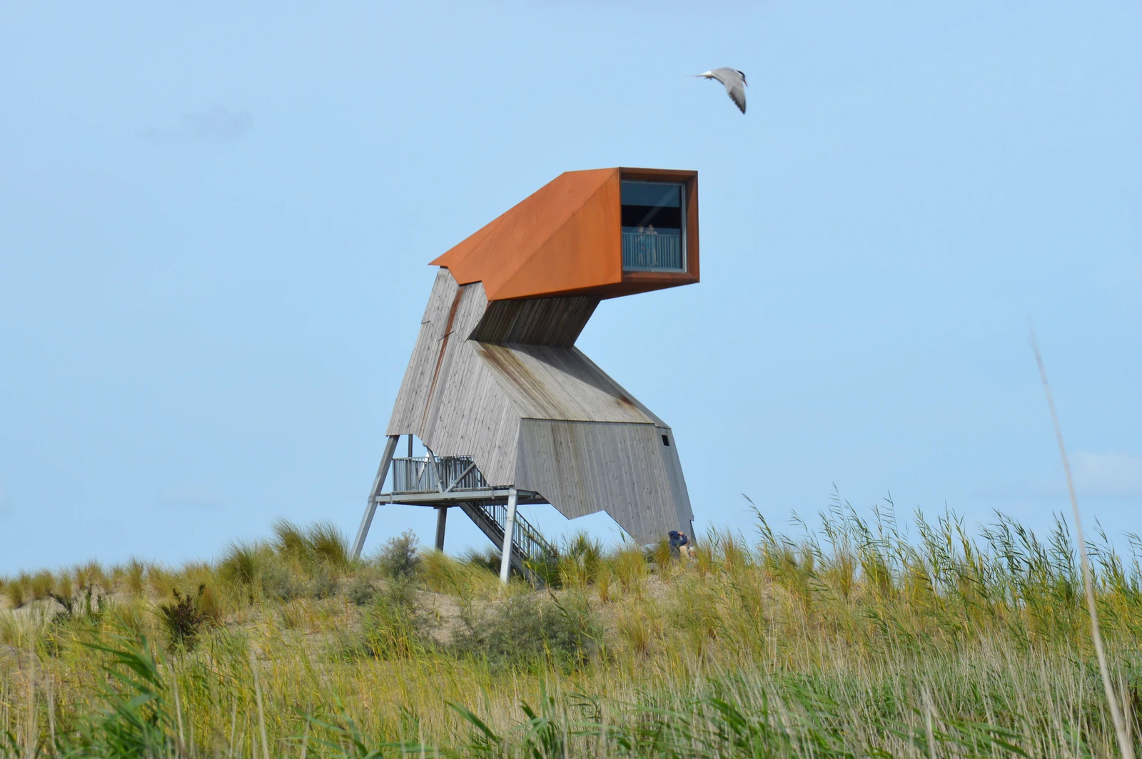
Two routes show the island: the Kustroute of about 7 kilometres along the outer edge, and the Vogelvluchtroute of just over 3 kilometres past the silt flats. The De Steltloper lookout tower is the highest point; in clear weather, according to Natuurmonumenten, you can see as far as Enkhuizen and Almere.
Practical information & useful links
- Ferry: departs from Bataviahaven 1, Lelystad. Return €29.50; Natuurmonumenten members €20.50; children aged 4 to 12 €12.75; up to and including 3 free. Tickets in advance online, for a fixed outward and return sailing. Dogs are not allowed on the ferry. See boat to Marker Wadden (in Dutch).
- Excursion: can be booked with the ticket, 1.5 hours, €10 per person (members €7).
- Island pavilion: open daily from April to October, roughly from 11.00 to 17.00. On the island you can only pay by debit or credit card.
- Birds by season: bird watching on Marker Wadden (in Dutch).
- Houtribdijk and N307: Rijkswaterstaat on the weight limit (in Dutch).