Elburg: from the botters through the Vischpoort
The old fishing harbour and the straight street plan of the fortified town together tell how Elburg lived from water and land.
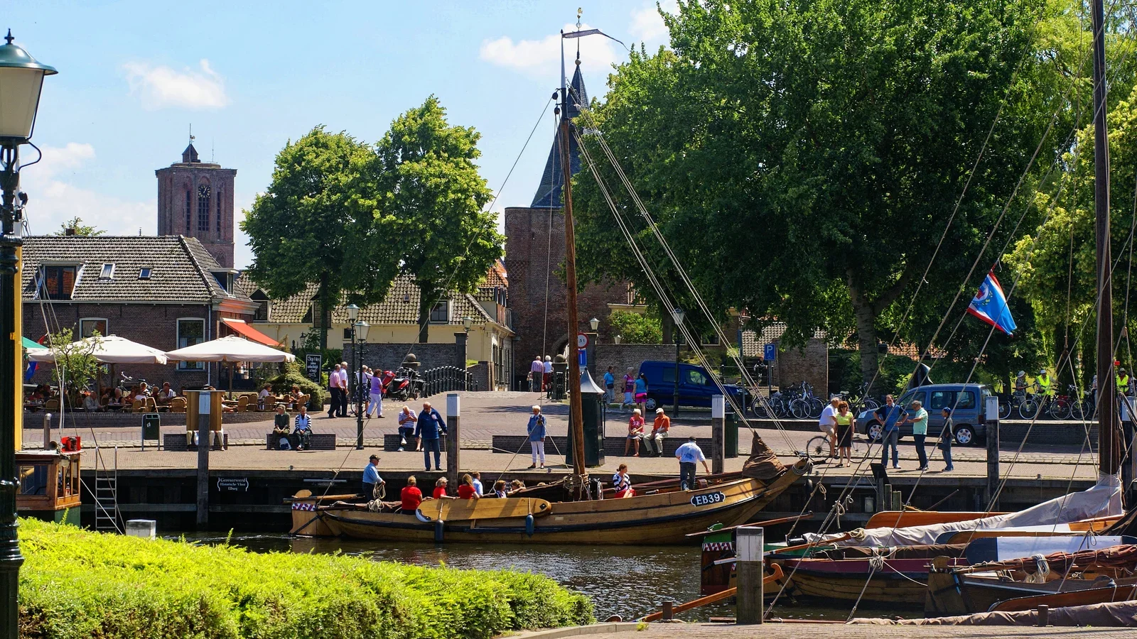
In Elburg’s harbour, botters lie in front of a city gate. The Vischpoort links two sides of the same story: behind the passage lies the rectangular fortified town, in front of it the quay of a former Zuiderzee harbour. October is precisely when that is an attractive combination for a walk. Bezoek Elburg has announced the programme Herfst in de Vesting for 10 to 24 October 2026. No separate festival programme is listed in the agenda for Tuesday 13 October, but the harbour, gate and streets give enough to go on, even without an event, to explore the fishing past.
According to the local tourist organisation, Elburg received city rights in 1233 and grew into a trading place. In 1392 the Duke of Guelders instructed his steward Arent thoe Boecop to relocate the town. The result was a design of about 415 by 250 metres with a straight street plan. Two axes, the Jufferenstraat and Vischpoortstraat, and the watercourse called the Beek divide the town into four quarters. Walking in from the Vischpoort is therefore different from simply following an old little street: the layout itself tells something about the plan with which the town was built.
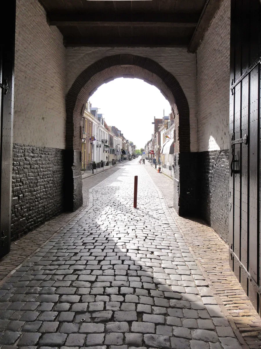
Around that pattern lay an earthen rampart with an extra moat. Casemates for artillery were built into the ramparts. Of the city gates, according to Bezoek Elburg, only the Vischpoort survives, partly because it kept a function as a coastal light. In the nineteenth century the ramparts and bastions were lowered and a park was laid out. Even so, the rectangular fortress shape remained visible. Anyone who walks around the centre and then goes through the gate into the streets experiences the difference between the green edge and the tightly arranged interior.
The quay recalls yet another way in which Elburg lived by the water. Bezoek Elburg calls the place an old fishing town on the former Zuiderzee. The original fish auction hall has been converted into a museum by the harbour; there, according to the organisation, nets, baskets and ropes, among other things, are shown. At Bottermuseumwerf De Hellege the history of fishing is likewise visible, with botters and old crafts. That gives the ships in the harbour context. They are not loose stage props, but refer to the work of fishermen, traders and shipbuilders.
Anyone who wants to follow that history with explanation can book a group harbour walk with Bezoek Elburg. The organisation describes a route of about an hour and a half with a guide past the fish auction hall and the botter yard. This is explicitly a group activity; for an independent visit, museum admission and opening hours must be checked separately. The outdoor route can be simpler: start on the Havenkade, look at the Vischpoort and then walk into the fortified town via the Vischpoortstraat. With each step the perspective shifts from harbour work to the planned urban fabric.
In this period the announced autumn programme adds walks, treasure hunts, exhibitions and concerts. The agenda lists, as ongoing options, a Green Ramparts Walk and exhibitions in Elburg, among others, but does not tie every item to an exact time on Tuesday 13 October. According to the agenda, the autumn fair, fashion shows and tastings are on Saturday 17 October; they therefore do not belong to a visit on the thirteenth. For the historic outdoor walk, such a reservation is not the core of the plan.
A tour of Elburg can therefore link two lines. The first follows the harbour and the traces of fishing; the second goes through the Vischpoort to the straight streets, ramparts and moat of the fortified town. The route shows how the place was laid out both on the water and on land. You do not need to tick off all the sights to understand the connection. At the gate, look back once more at the quay: there it becomes clear how close the world of ships and that of the walled town lay together.