Utrecht
Utrecht

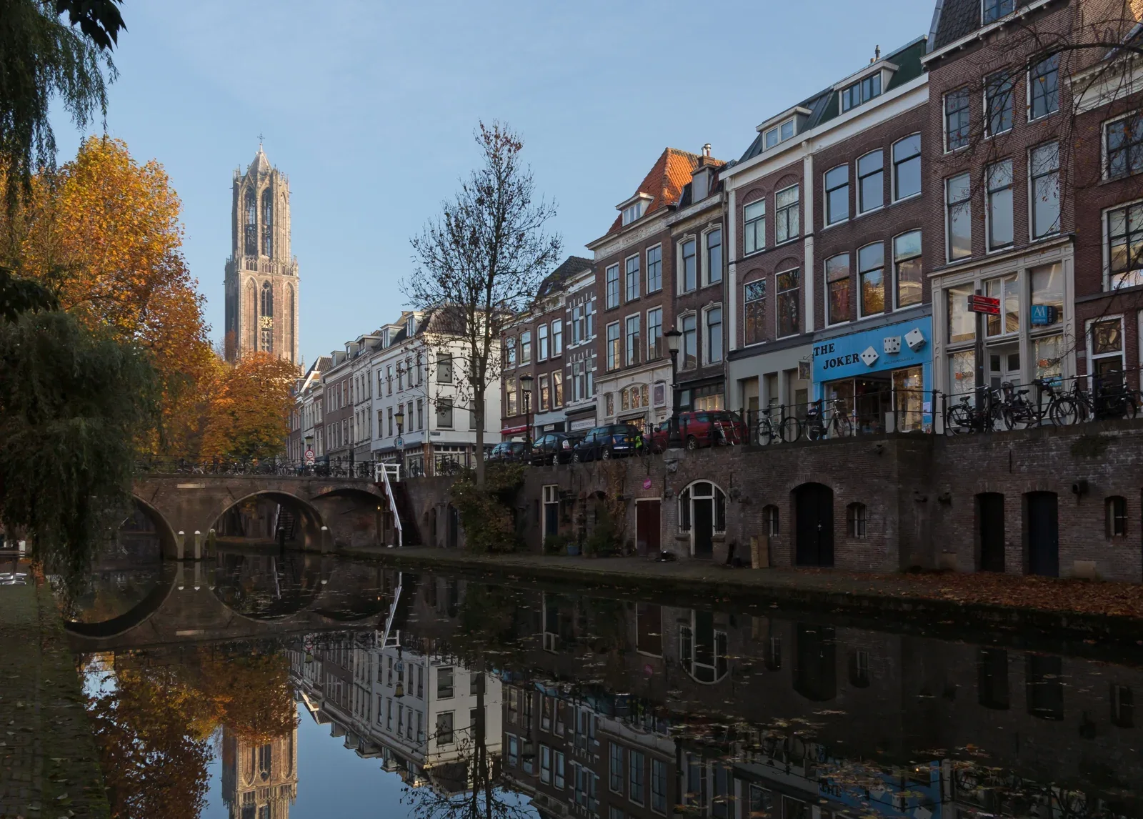
Beside the Oudegracht, Utrecht occupies two levels. The street runs above the lower quays and the entrances to the wharf cellars. The municipality describes how these cellars developed from connections between the waterfront and the cellars beneath the houses. A feature that now defines the city’s appearance therefore has a practical history: goods needed a route from the water into storage.
Above this low waterfront, the Dom Tower remains a landmark. Around Domplein, the city takes on a vertical scale, while the canal draws attention along houses and bridges. Centraal Museum adds another collection of stories. Art, fashion and design show how objects, images and ideas also help to shape a city.
There is space beyond the compact centre as well. Zocherpark follows the city moat, with trees and paths on the site of former defences. Further away stands De Haar Castle in Haarzuilens, within the municipality of Utrecht. The castle and park make a separate outing. A day in the centre can remain focused: Domplein, a museum and the Oudegracht offer a route connecting height, art and water.
Places in Utrecht

Domtoren
The Dom Tower gives Domplein its recognisable silhouette. A guided visit brings the tower’s history into a different scale from the view at ground level; available visits have a reserved start time.
Domplein 9, Utrecht

Centraal Museum
Centraal Museum connects art with fashion, design and city history. The museum on Agnietenstraat offers a different perspective on Utrecht from the monuments along its streets.
Agnietenstraat 1, 3512 XA Utrecht

Kasteel de Haar
De Haar Castle stands in Haarzuilens, within the municipality of Utrecht. The castle, gardens and park form a destination outside the central day route, with different visiting options for the building and grounds.
Kasteellaan 1, 3455 RR Haarzuilens
A day in Utrecht
This example itinerary stays within the city centre: Domplein first, then art and finally the Oudegracht. There is space for lunch between the first two stops; available tickets and guided visits determine the final arrangement.
10:00–11:30 · Domplein / Domtoren
Domplein is the starting point. The tower puts the scale of the surrounding houses into perspective. A suitable reserved visit can also bring the story of the Dom Tower into the morning.
13:00–15:00 · Centraal Museum
After lunch comes Centraal Museum. A selection from the art and design collections gives the afternoon a subject alongside the architecture and history visible in the streets.
15:30–16:30 · Oudegracht
The Oudegracht is the final stop. The difference between street level, quays and water explains much of the cityscape. The lower cellars recall the storage and movement of goods.
More about Utrecht

From the Oudegracht, the Dom Tower remains visible between houses and bridges. Tower and low waterfront offer two different ways of reading the same city. The Holland story below explores that connection in more detail.
Utrecht between the Dom Tower and its wharf cellars: a city on two levels
This local story considers the Dom Tower, the wharves and the difference between street level and the waterfront in Utrecht.
Key figures and transport
Population
378,121
Area
99.21 km²
Water
5.36 km²
Localities
4
Reference date · 1 January 2026
Stations
From city wall to park

Green space beside the city moat
Zocherpark was created on the site of the former city walls. Trees, paths and the water of the moat now form a green edge to the centre. The park also tells a story of how a city boundary can change its purpose.